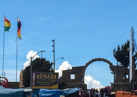
Copacabana, Departamento de La Paz, Bolivia: Bolivia and I got off to a bad start, but I’m still willing to give it some time to win me over.
Apparently rules about visas change with some regularity. From what I read, and was told, I thought I could buy a visa at the border as I did going into Argentina. That was not entirely true.
At the Kisani border crossing we flew through Peruvian emigration and immediately hit a line on the Bolivian side: not a good sign.
When I finally got to the front I learned that I also needed to fill out an application complete with a passport sized photo. I asked the immigration officer if I could cut out the picture from a copy of my passport and was told that wasn’t good enough. I asked him where I could get a picture taken and he told me there was a shop in Copacabana that did them.
I looked the man in the eye and asked him what we were going to do. He had a passport picture on his desk from another application of a pretty Argentine girl. He picked it up and said, “this is you.”
The visa cost bs/360, I have given him 370 but it didn’t seem prudent to quibble over $1.40 in change. After an hour and a bit I got back on the bus and continued on to Copacabana.
At least the road is paved.
***
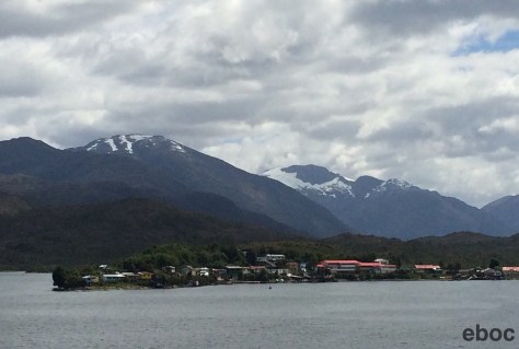
Copacabana is a fairly rundown resort town. The main source of income is tourism and ferrying visitors to and from Isla del Sol and Isla de la Luna. Given that the locals’ livelihood depends on tourism you would think they would be good at it.
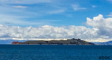
La Isla del Sol is beautiful. The lake is a deep blue, the puffy clouds are low over the Andes on the distant shore, and the verdant hills are plowed into gradual terraces.
I took a ferry to the north side of the island and hiked the road that runs the length of the island to the south. It’s only a little over 8km but the beginning is straight uphill. I was walking with a New Zealander and we took a wrong turn at one point and ended up walking through a sheep pasture and potato field.
The south side of the island is more populated and looks like a dilapidated Positano. From the restaurants on the hill I got a great view of La Isla de la Luna.
The next day I visited La Isla de la Luna. It was important to the Incas because it was believed to be from where Wiraqocha controlled the sun and the moon.
The uncommonly disagreeable boat driver gave us 40 minutes to visit the island, as opposed to the hour we were promised.
I sprinted through the temple and snapped a few pictures of the snow capped mountains before we headed back to La Isla del Sol.
After another meal of grilled trout I decided it was time to leave Copacabana.
Puno, Puno Province, Peru: On Wednesday morning there was a strike on Peruvian-Bolivian border that complicated the border crossing.
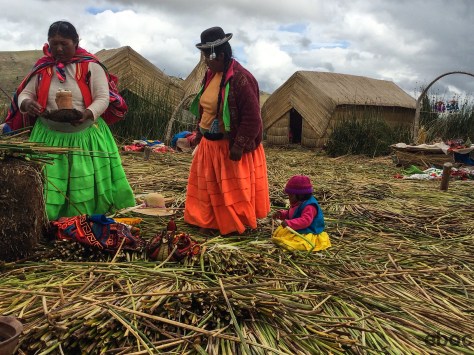
So I stayed in Puno and went to the floating islands on Lake Titicaca to see the Uros people. (Fun fact about Puno: according to a guide, a lot of houses are unfinished so that inhabitants pay lower taxes.)
It is just as touristy as you would imagine. But unlike a lot of the floating islands in Vietnam these are still made out of reeds instead of plastic or fiberglass. There are some islands that have decided not to allow tourists.
The first island I visited had 20 people living on it. Ana, 54, lives with her husband in one of the huts on the island. Two of her five daughters still live on the island with their husbands while the other three have married and moved to other islands with their husbands.
Most of the older men work as fisherman on the lake, but the younger men go into Puno to work as taxi drivers or in construction.
The women stay on the islands to cook, change the reeds on the houses, or to add another layer of reeds to cover the island. They also have an opening in the island through which they farm fish.
There was one solar panel on the island near the kitchen. The other houses get hooked up to the solar panel. If the power goes out they have to light candles and put them in ceramic bowls to avoid the island catching on fire.
There were ten adults living in five huts. The rest were children of varying ages. On the islands the children go to school from ages 5 to 12. Since there is no high school, after 12 they have to go into Puno, which would probably take an hour each way.
Their diet consists mostly of fish that the supplement with rice and quinoa. They were fairly big women. On Saturdays they go into Puno to buy grains and milk for their babies.
The babies chew on the end of the fresh reeds. The reeds are rich in calcium, and since they do not brush their teeth on the island chewing on the reeds helps their teeth to develop. The calcium is also good for their bones. They taste like watery bananas.
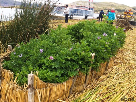
We went to a bigger island, which had a cafe and a little market. This island also had a garden on it with several potato plants.
On the one hand it is cool that they continue to live as people have on Lake Titicaca for thousands of years. But on the other hand the lifestyle seems profoundly boring and hard.
In the afternoon, when I got back to Puno, I walked around the city. I passed by a bank and saw a line of women from the highlands dressed up in their city best waiting to cash their welfare checks.
Puno, Puno Province, Peru: I decided to take one of the tourist buses from Cusco to Puno to see more of the country side and local culture.
The first stop was a Jesuit Church in Andahuaylillas. The church was built in the 17th century and taken over by the Dominicans when the Jesuits were expelled from Peru in the 18th century by the Spaniards.
After Peruvian independence from Spain the Jesuits returned to Peru and the church became Jesuit again.
The second stop was another Jesuit Church in Huaro. Also built in 17th century it was abandoned in the 18th century.
Because the Domicans did not use the church over the years it fell into disrepair. When it was first built it was covered in mural paintings. The locals refer to it as the Sistine Chapel of the Americas.
It is odd that there are such opulent churches in remote mountain towns. The Viceroy of Toledo constructed the towns and built the churches as the Spanish came through.
The conquistadors kicked the Incas out of Cusco and placed the elite Incan families in the surrounding towns.
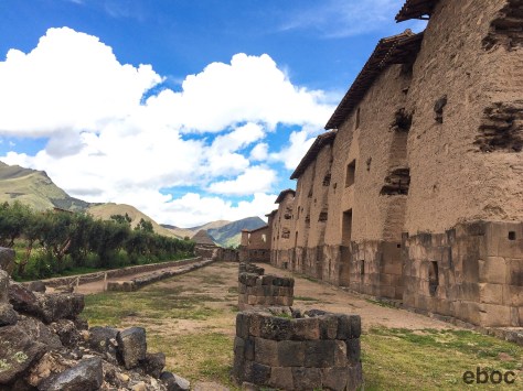
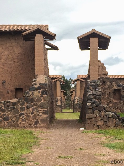
The third stop was in Raqchi, which is known for the temple of Wiraqocha. On the border between Quechua and Aymara territories, Raqchi was an important check point and had many silos to store grain collected in taxes.
There was push back from some of the pre-Incan people who resisted Incan rule and the Incan gods. The town was surrounded by a wall that was 2 meters wide, 3 meters high, and 5 kilometers around.
The ninth Incan leader, Pachacuti, built the temple to Wiraqocha, which was 92 meters long and 22 meters high. He erected a statute of Wiraqocha that the Spaniards destroyed: the body is in Cusco and the head is in Madrid. Pachacuti also built Machu Picchu.
He incorporated pre-Incan gods into the Incan pantheon. Wiraqocha was the creator and could not be seen, as opposed to the sun that was the principal god for most pre-Incan religions. By giving the conquered people a visual it helped them adopt Wiraqocha as the principal god.
The fourth stop was at La Raya Pass. At 4335m it is the border between the Province of Cusco and the Province of Puno.
The fifth stop was in Pukara. Pukara was a town constructed by pre-Incan and pre-Christian altiplano people. They abandoned the city over 2000 years ago because of a long drought and fled to Lake Titicaca. The people who migrated joined the fledgling Tiwanaku culture, which spread as far south as the Atacama desert.
The cathedral was constructed from the ancient Pukaran mammoth administration building. The cathedral is large but it didn’t use up all of the stones form the ruin.
Today Pukara is known for making ceramic bulls that people put on the roofs of their houses for protection.
We spent the next two hours driving through the altiplano, through little villages and past women herding cows, sheep, and llamas. The mountains were beautiful and the landscape stark. I was reminded of a quote from The Quiet American by Graham Greene:
If I believed in your God and another life, I’d bet my future harp against your golden crown that in five hundred years there may be no New York or London, but they’ll be growing paddy in these fields, they’ll be carrying their produce to market on long poles, wearing their pointed hats. The small boys will be sitting on the buffaloes.
About an hour outside of Puno is the city of Juliaca. My tour guide informed us that it has two claims to fame:
It is the largest city in Puno Province;
It is best known for having a large black market devoted to electronics and other items smuggled in from Bolivia.
My personal observation: it has all of the charm of Irbid, Jordan down to the cinder block houses and dirty streets.
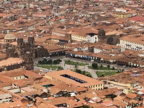
Cuzco, Cuzco Province, Peru: The biggest surprise of my trip has been Cuzco.
I heard everything from “its a dump” to “interesting provincial town.” And while it is not the capital, Cuzco is enormous and growing quickly thanks to tourism. There is a lot to see and do.
In stark contrast to my experience in Chile, when I first landed in the airport and was waiting for my bag by the carousel I felt unusually tall and out of place — until a group of German tourists walked into the room. The cusqueños are not tall.
The city has quadrupled in size in the last twenty years and now has close to 1 million people. I will admit that the newer part of the city is not the main draw.
In Quechua, Qosqo means center: it was the heart of the Incan empire.
From the look-out below the Christ the Redeemer statue you can still see that old city is in the shape of a puma.
The Plaza de Armas is beautiful: the Spanish did have a certain flair. It looks like it could be in Seville. The plaza has two big churches and is ringed by an arcade.
A few blocks away is the Convent of Santo Domingo. The conquistadors built the monastery and church on the foundations of an Incan Temple. The foundations are still impressive: the temple must have been monolithic.
Because the indigenous culture and language are still strong and vibrant in Cuzco and the surrounding region reminders of the Spanish conquest seem to hit harder than they do in Argentina or Chile. There is an anger that isn’t quite as evident in other parts of South America.
But that anger isn’t only reserved for the Spanish. Especially true in the mountains, the locals do not refer to Lima – they talk about the “Capital” and people from the Capital, like something out of The Hunger Games.
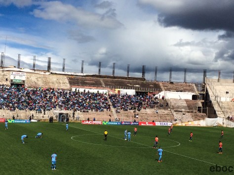
The day after we got back from the Incan Trail several of us from the tour went to a soccer game between Real Gracilaso and César Vallejo. The other team, César Vallejo, comes from the coast. As at all soccer games the trash talk was wonderful and colorful but the history of animosity between the two teams made it especially rich.
Some great fights broke out on the field. It felt more like a hockey game than a soccer match.
One aspect of the local culture I liked is that there is no word for goodbye in Quechua. The people say see you later, Tupananchiskama, whether in this life or the next.
I did not have a religious experience on the Incan Trail. But as I hiked down from the sun gate, the mist lifted and I caught my first glimpse of Machu Picchu below, I fully understood why someone might.
Setting off for the trip from Cuzco my tour group drove through the Sacred Valley. We went to an Incan site that overlooks Cuzco, Saksaywaman;
– an animal preserve;
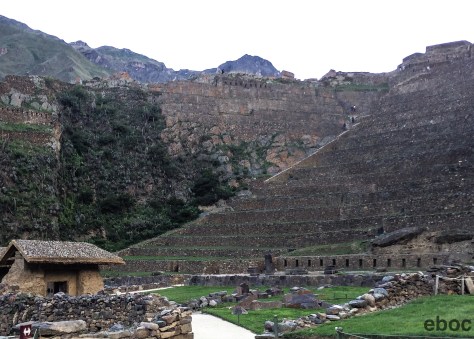
– Pisac and ended in Ollantaytambo.
The ruins in Ollantaytambo, both Incan and pre-Incan, are wonderful. From the Sun Temple we watched the sunset over the valley. The steps up to the temple were also a good warm up for what was to come.
The night before we were set to leave for Kilometer 82 (the modern-day start of the trail) our guide, Roger, told us the President of Peru was coming to Cusco and there were going to be protests throughout the province.
As a result, G Adventures, through which I had booked the trek, was bringing the porters in from their villages to make sure we could set off on time. We had to leave by 5 am before the roads were shut down.
What Roger did not tell us was that the buses we were supposed to take to km 82 were still in Cuzco with our tents, sleeping bags, and — most importantly — our tickets to get onto the trail and into Machu Picchu.
The buses left Cuzco at 2 AM but still ran into trouble. According to the assistant guide, Javier who came out on one of the buses, they saw fires along the way and road blockades. They ended up coming by back roads.
After we were loaded up, the local inhabitants wouldn’t allow us out of Ollantaytambo on the tourist buses. We had to use local minibuses (pay the toll man sort of thing) which are made for shorter Peruvians, not long legged Americans or Australians. We moved over to the vans and set off on a back road.
I’m using “road” loosely here; I think it was more of a cattle path. We crossed over the river at one point, which was running high because of the rainy season, and Javier told us that it was a new bridge because the old bridge had washed away last year. I felt that was unnecessary information and was glad that I heard it after we had used the bridge.
We stopped to wait for some bucking bulls to get out of the middle of the road, but otherwise the trip was uneventful and protest-free, albeit a little cramped.
At Kilometer 82 we went through the check point and by 7:45 we were off and running: or rather sauntering. The first day was comparatively light and we were at our campsite by midday.
The tents had been set up, but we arrived more quickly than expected, so lunch wasn’t ready for us. For the Incan Trail in March it was bloody hot. That and the altitude made the hiking slightly challenging.
Coming off of Torres del Paine, which was basically at sea level, I felt as though I was in pretty good shape. And for the entire three and a half days neither my feet nor my legs hurt. However, my lungs were on fire.
In fact, if I had a different set of lungs the whole thing would have been a much more enjoyable experience.
Day in and day out the men all shot up ahead, closely followed by the runners. And the rest of us who had grown up at sea level straggled into the break points or camp at different rates.
Even more frustrating, or impressive, are the porters who trot along with 50kg on their backs in sandals or cloth shoes. Many of them are not young.
Llaqtapata
Along the trail we passed other ruins, refugios and relay stations that the Incas used on their way to Machu Picchu.
On the way up some of the steeper inclines I thought several times that the Incas were completely crazy to choose Machu Picchu as the location for their sacred city and to build this particularly difficult trail to reach it.
But then I would go around a corner and have a breathtaking view of the mountains and the river, and it would make sense again.
The second day was hard. Our campsite the first night was at 3600 meters. We climbed to over 4000 meters by noon and then dropped down to 3800 meters where the second campsite was.
The pass between two mountains is called dead woman’s pass because from below it looks like a woman in repose. I think there’s a nice double entendre there too.
Regrettably, it rained on the second day, so when we got to the pass at 4200m we couldn’t see anything. The Trail is closed during February, the height of the rainy season, for maintenance and is cleaned and fixed for the coming year.
I’m glad I was there at the beginning of the season because the steps on the way down from the pass were already covered in moss. And it was raining so hard the water cascaded down the rocks like a river.
I kept up a steady mantra of “you will not fall” in my head and made it down unscathed. I got about halfway down when Javier decided I was going too slowly and grabbed my elbow to help me along claiming that he was better than a hiking pole. Two steps in he immediately slipped, inspiring real confidence.
As soon as I got to camp it stopped raining, and we had a beautiful view of the valley.
The third day was a little bit shorter. Machu Picchu is only at 2800m, so we had to go down 3000 steps. The porters run down the steps, which has to be great for their knees.
It was only drizzling, which made it misty and added to the mysticism of the place.
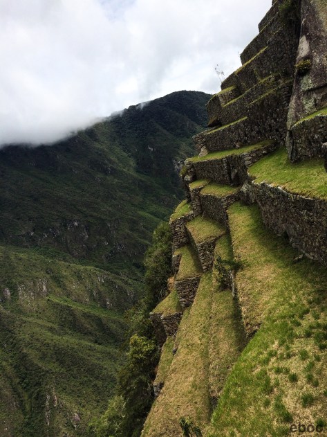
Right above the campsite are the Intipata and Wiñawayna ruins. They get short-changed by their proximity to Machu Picchu.
Intipata
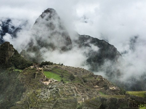
We arrived on the fourth day. Everyday was an early start, but the 3:30 wake up call didn’t seem so bad because I was jazzed about finally arriving in Machu Picchu!
We practically sprinted to the Sun Gate. Our guides had said that the Sun Gate can sometimes be a disappointment because it is often cloudy in the early morning and the view isn’t spectacular.
About 100m beyond the Sun Gate we got our first glimpse of Machu Picchu, and it was staggering.
It is everything I dreamed it would be and more. The steep terraces are bisected by even steeper stairwells.
It’s full of inventive temples and elegant houses for the nobles who came to Machu Picchu in its heyday.
Condor Temple
Machu Picchu means old mountain. Next to it is the smaller Waynu Picchu, which means new mountain.
On the trail I was surrounded by my 15 fellow hikers, 22 porters, 2 guides, and another 20 people I saw along the way. When we arrived at Machu Picchu, there were hundreds of other tourists walking around. It was a shock to be back in the world with so many people.
After a few hours in Machu Picchu, we took the buses down to Aguas Calientes, the way most tourists arrive. After a celebratory lunch we had a rather raucous train ride back to Ollantaytambo followed by a more subdued bus ride to Cuzco.
Hiking the Incan Trail was a fantastic experience. No matter how arduous it seemed at the time, coming down the mountain towards Machu Picchu after three days in the woods was an indescribable feeling and provoked a sense of euphoria I hope to have again.
San Pedro de Atacama, Provincia El Loa, Región Antofagasta, Chile: It’s been a while since I’ve been to a desert. I left Jordan in 2009 and haven’t been to a landscape as stark as the Atacama Desert since then. As a guide said to me, “the desert is beautiful but it is lonely.”
The town is very cute and looks like something straight out of Butch Cassidy. The adobe buildings are in the shadow of the Lascar Volcano that perpetually has a smoke cloud above it. San Pedro is a lot of fun and there are many wonderful things to do, but sleeping is not one of them.
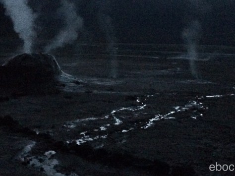
My first day I left at 4:30 to go to the Tatio Geysers. Their claim to fame is being the geysers at the highest altitude in the world: 4200 meters. I thought the town, at 2400 meters, was high enough. Apparently altitude sickness is a real thing.
The geysers are very close to the Bolivian border. The Atacama desert and the entire northern section is part of the land Chile won when it defeated Bolivia and Peru in the War of the Pacific that ended in 1883.
We had to get to the geysers early because by 9 it is difficult to see the steam in the sunlight.
The water is 85 degrees Celsius and in the early morning the air is at about 0 degrees.
I can tell you that the stars up on the plane were brilliant at 6:30, but with so little light it was difficult to take pictures.
As we descended down the mountains I started to feel better almost immediately. We stopped several times:
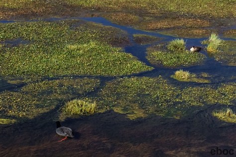
– to see flamingos;
– at wetlands where there were red footed ducks;
– to see giant cactuses;
– and in the town of Machuca.
Our guide rather tongue-in-cheekily referred to it as a metropolitan area. The highlight of the village were the llama skewers and goat cheese empanadas.
Near San Pedro are two valleys: Valle de la Luna and Valle del Marte (Moon Valley and Mars Valley). They were named by a Belgian missionary. In the daylight rocks and sand in the Moon Valley look practically white, and the Mars Valley looks red. The Belgian monk’s Spanish was not very good and so the name was transcribed as Valle de la Muerte (Death valley).
The sunset in Valle de la Luna was really wonderful. As the sun set the different shades of red in the rock. It was a relatively cloudy night, which really enhanced the sunset.
The next day I went on a tour of highland lakes.
The first stop was a flamingo reserve. The flamingos were in a lake in the middle of a field of sulfur. The smell was potent to say the least.
I saw two types of flamingos: the Andean and Chilean Flamingos. The Andean has black tail feathers and the Chilean moves its legs in a distinctive way to disturb the water and bring the brine shrimp to the surface.
At the preserve I learned more about how the salt flats formed and why the flamingos have a pink tinge to their feathers (from eating brine shrimp) but the guide did not explain how the flamingos ended up on lakes above 2500m hundreds of miles from the coast.
After the preserve we went to another major metropolis: Toconao (at 2500m).
What I loved about these little towns, apart from their picturesque beauty, are the signs that we saw entering and leaving: Zona Urban (“Urban Zone”). All over northern Chile and eastern Peru are towns with 200 inhabitants and Urban Zone signs.
After several more hours of driving we made it to the salt lake. Very close to the Argentine border, because of the amount of nitrogen in the ground the mountains appear red.
Very near to Salar de Talar the lake is at the base of Cerro de Aguas Calientes. At 4000m the banks of the lake were unsurprisingly windy and cool.
Depending on the light and the wind the water turned from green to blue to purple.
Between lakes we drove past vicuñas in the shadow of a volcano. Vicuñas are the smallest of the four Andean camels and have the finest wool.
Our last stop was at two lakes that are separated by a ridge: Lagunas Miscanti y Meñiques at 4300m. The guide dropped us off beside Lake Miscanti and told us to walk to Lake Meñiques where he would have lunch set up and waiting for us. I was shocked how out of breath I was by the time I got to the top of the hill. Two days is not enough time to adjust to high altitude.
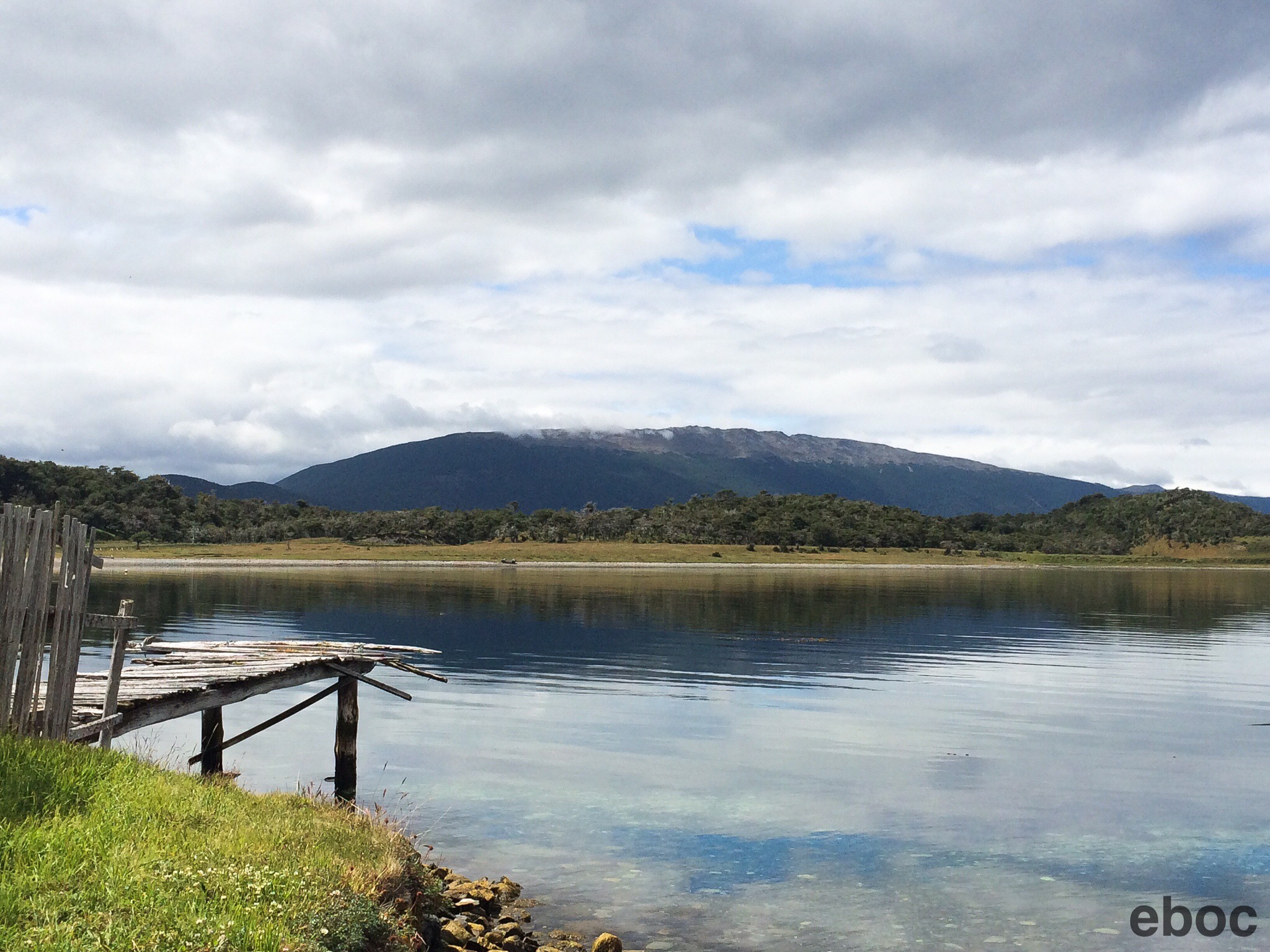
Puerto Natales, Última Esperanza, Región Magallanes, Chile:I headed south from Puerto Montt to Puerto Natales on a Navimag Ferry.
I had never been on a cruise before but this was pretty stripped down with no frills. It is part cruise ship, part cargo ferry: there were about 75 passengers and several trucks hauling everything from vegetables to construction materials. Thankfully I was not on the cattle hauling route.
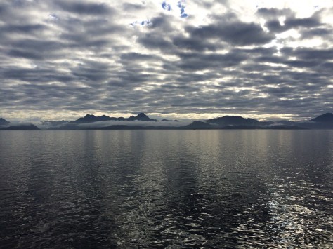
Instead of heading south on the Carretera Austral the boat wove in and out of canals and straights, down the Pacific, past fjords and glaciers to Puerto Natales.
We were led by a German who gave lectures on the local flora and fauna. Perceval was very knowledgeable and what he lacked in fluency in English he made up for in indefatigable enthusiasm for the subject matter.
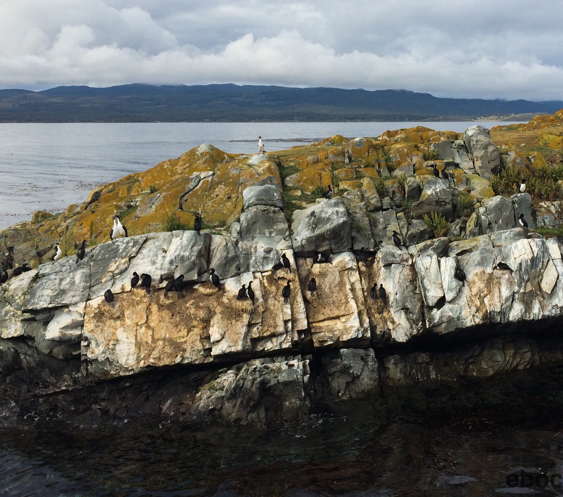
We saw enormous jelly fish, playful river dolphins, and many kinds of birds. There were many condors and cormorants but also a lot of albatross. I did not see one of the gigantic wandering albatross from Samuel Coleridge’s poem, The Rime of the Ancient Mariner, but even the smaller version is an elegant bird.
The passengers were an interesting mix of nationalities and backgrounds. I shared a cabin with Anna, a Dutch woman who worked in the legal department of the national welfare system and had taken a leave of absence from her job to travel in South America for three months. In the cabin next to ours were a Dutch doctor and nurse. There was also a guitarist from Rotterdam. For a relatively small country the Dutch were well represented on the boat. Most of the passengers were French and German, but of course there were several Americans as well.
We sailed for four days and three nights. For 16 painful hours we were on the Pacific Ocean and got to experience seasickness first hand. The captain informed us that it was pretty calm on the ocean and thank goodness for that otherwise it could have gotten really unpleasant. I had dinner with the Dutch couple one night and the nurse looked really green. It was the first time I had understood that expression.
We landed in Puerto Natales and most people headed off to start their treks in Torres del Paine. I signed up to do the full circuit with a group many months before and a had a few days to kill in Puerto Natales.
Fresh off of kayaking in El Calafate I decided to do it again on the channel. The wind on the western side of the Andes is stronger than on the eastern side so kayaking this time was a bit harder.
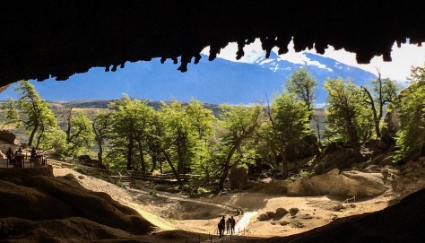
Near the town are caves where the skin of a Mylodon (giant ice age sloth) was discovered in 1895. The remains of other Mylodons were subsequently discovered and the skins are in Europe, but the caves are still being excavated to search for more ice age creatures.
I think I’m too tall to really enjoy caves. After hitting my head for the third time in one of the smaller caves I decided spelunking is not in my future. However, the sillón del diablo (devil’s armchair) nearby offered great views and was fun to climb.
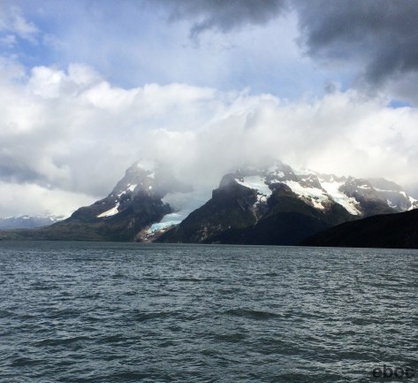
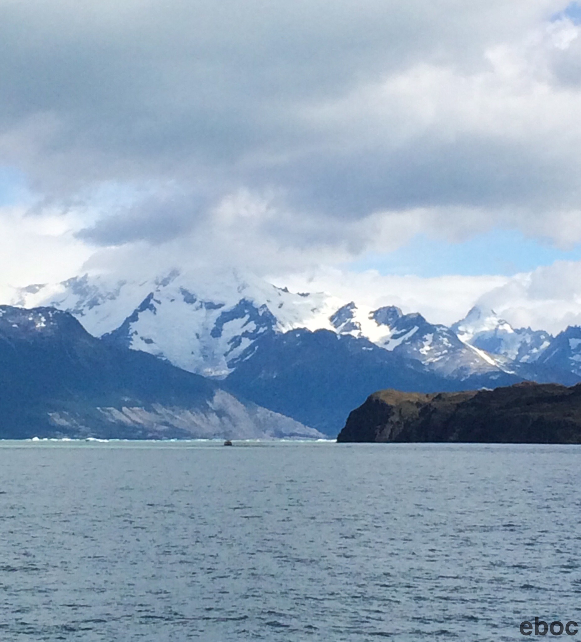
I also went to Bernardo O’Higgins National Park and saw two more glaciers Balmaceda and Serrano. The glacier on Monte Balmaceda dramatically comes down to the fjord.
It was snowing at the top of the Serrano Glacier, so it rained where I stood at the base. I watched pieces of the glacier plunge into the water.
San Sebastián, Tierra del Fuego, Argentina/ Chile: I crossed the border into Chile today, and the Brit sitting on the bus next to me compared the experience to traveling in Mongolia.
First we went through Argentine border control. Everyone had to get off the bus, have their passports stamped, and get back on the bus.
Then we drove through “no-man’s-land” on a dirt road for 10 miles. It took about half an hour to get to Chilean immigration. After going through immigration I naively thought we would be on a paved road again, but we continued on a dirt road until we were about two-thirds of the way up Tierra del Fuego. We passed multiple billboards announcing that the Chilean Government is going to pave the road.
After a short ferry ride it took us no time at all the get to Punta Arenas. Instead of the twelve hours predicted it only took ten to get from Ushuaia to Punta Arenas.
Punta Arenas surprised me. It’s more attractive than I thought it would be: the Plaza de Armas is quaint and the promenade along the waterfront is much more attractive than the one in Ushuaia. They have their own pingüinera and colony of sea lions, which I didn’t have enough time to see.
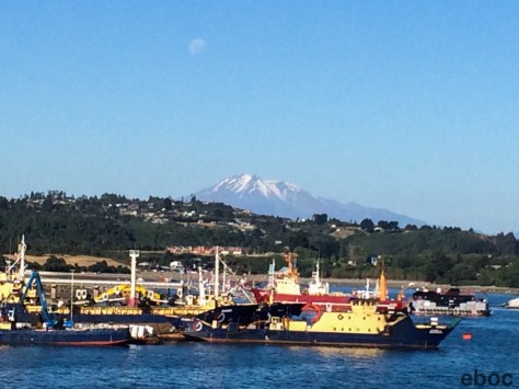
What was underwhelming was Puerto Montt. Twenty four hours is the right amount of time to spend in this industrial port city: the city isn’t charming. There is a nice strip along the water with artisanal shops and good seafood restaurants. The harbor is full of islands that are short ferry rides away.
Mostly Puerto Montt serves as the jumping off point for Chiloé, the Lake District and fjords from Santiago, a function it fulfills well.
Ushuaia, Tierra del Fuego, Argentina: As happy as I am that I made it to “the end of the world” I don’t think you have to rush out and visit Ushuaia immediately (pronounced oo-swy-ah). The town is not particularly attractive and they do not make anything easy for tourists. What attracted me was the novelty of being so far south.
It strongly reminded me of Maine and parts of Canada. However, instead of big trees There are forests of small beech trees and wispy lenguas that can withstand the wind. In some areas the wind is so strong the trees grow sideways.
The harbor is pretty: big snow capped mountains run down to the shore along the Beagle Channel.
The national park is a few kilometers away but the buses to get out there are not run with the customer in mind.
The park itself is nice. It has 7-8 walks that are pretty easy. I mostly wanted to send postcards stamped “fin del mundo.” I stood in a kiosk filling out my postcards next to a woman from South Carolina and listened to Cher sing “If I could Turn Back Time.”
I hiked along Lapataia Bay for a few hours and saw the local flora and fauna before heading back into town.
The next day I took a catamaran (they’re very popular in Argentina) along the Beagle Channel to a penguin colony.
We saw sea lions:
– Cormorants:
– And two kinds of penguins — the Magellanic and Gentoo:
The boat tour ended at Estancia Haberton, built by early British settlers. Samuel Bridges arrived early in the nineteenth century and worked as a missionary to convert the Yamuna indigenous people to Christianity. After Argentina’s independence from Spain the government in Buenos Aires made a big push to settle the southern end of the country. When it became clear that he would no longer get a salary from England, Bridges went to Buenos Aires to secure the land for the estancia.
The national congress was satisfied because Tierra del Fuego was claimed for Argentina: border disputes with Chile were already on the rise. He foresaw conflict between the settlers and the Yamuna and tried to help them, but they were eventually wiped out.
The Estancia was pretty and looked a little like a Scottish farm.
While it wasn’t the highlight of my trip I am still glad I made it all the way south.
Los Glaciers National Park, Santa Cruz, Argentina: Possibly my favorite excursion in El Calafate was kayaking near the Upsala Glacier. This glacier is slightly to the north of Perito Moreno.
We got on a catamaran and went north across Lago Argentino to a fjord. As the glacier came into view we suited up in really heavy wetsuits. Ironically it was the hottest day I spent in El Calafate and bright and sunny by Patagonian standards. While the water was freezing and I was glad to have the wetsuit on the off hand chance the kayak capsized after a few hours of paddling it was quite toasty inside.
Oddly enough the excursion was run by Catalans from Andorra. Apparently there is a shortage of kayaking guides in Argentina and they were sent over in partnership with an Argentine company. Why a native North American tradition is popular in the Pyrenees is beyond me, but it was fun to hear Catalan Spanish accents again after six years.
Most of the two-person kayaks were anchored by men, so naturally I was put in the only boat with two women. I went with an Argentine from Puerto Madryn who had never done it before. Nora had a grand time taking pictures of the icebergs while her gondolier ferried her around. At first I was annoyed until I realized every time she “helped” we went headlong into a rock or, better yet, a massive piece of ice.
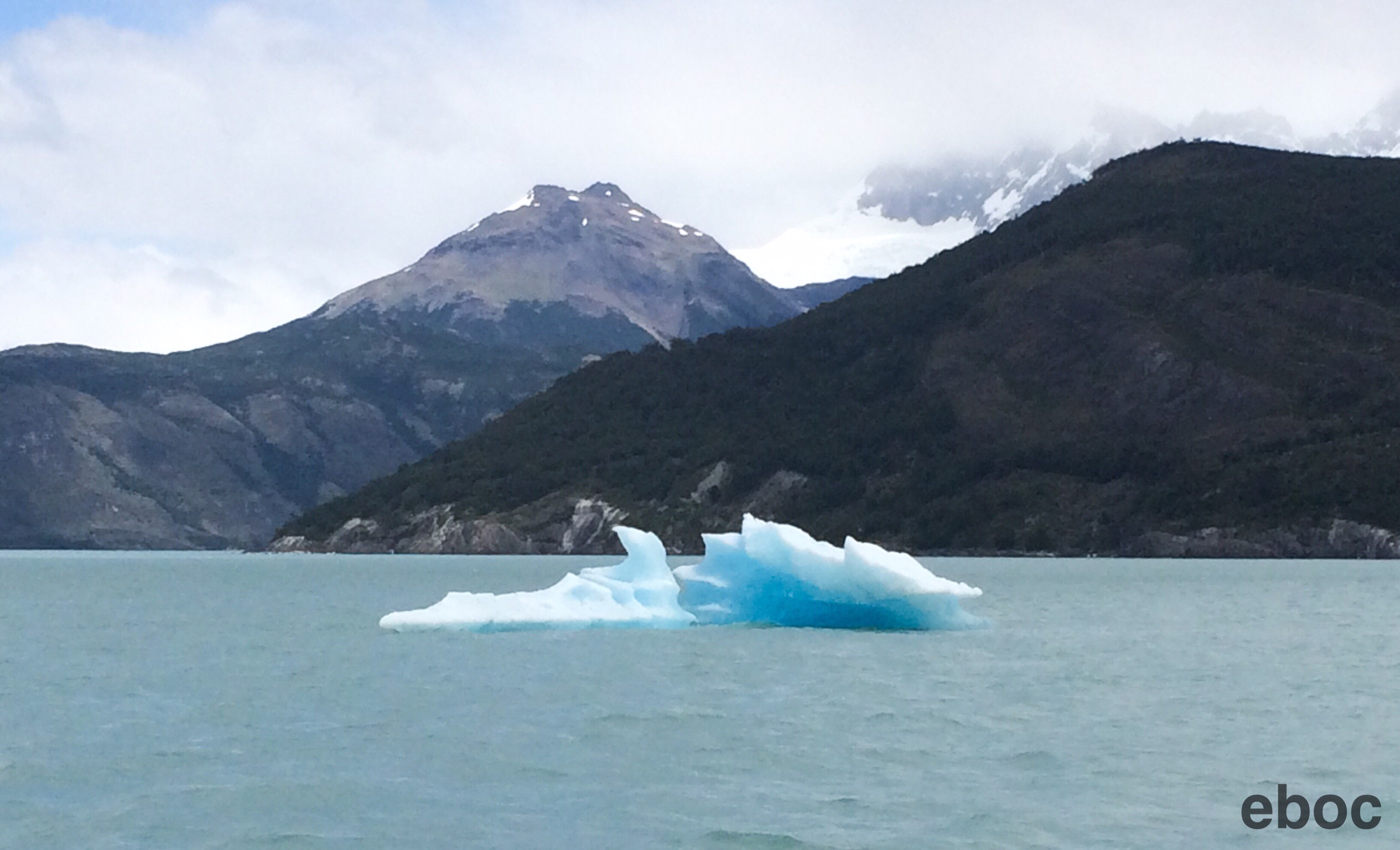
Upsala is receding, meaning that, unlike Perito Moreno, every time a piece of ice falls off the front of the glacier not enough is being generated at the top of the mountain to replenish it. We paddled around an area about two miles south of the glacier that 40 years early had been covered in ice. It wasn’t possible to get closer because the falling ice creates huge waves when it hits the lake.
Paddling among the ice floes was very beautiful and remarkably peaceful.