All posts by Redhead on Tour

In Death’s Corner

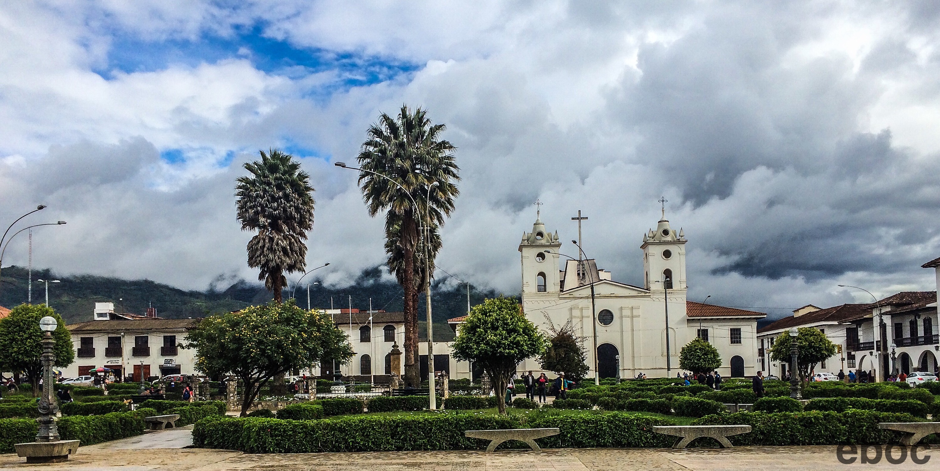
Ayacucho, Huamanga, Peru: I wanted to go to Ayacucho because of its infamous history, and most of the tourists I met there were Peruvians doing the same thing. 

El Sendero Luminoso (“The Shining Path”) so terrified the region that no one came to Ayacucho and anyone who could left it. 
A huge percentage of the population fled the region. And while the population in the city is recovering the countryside remains sparsely populated and littered with abandoned houses. 

The locals don’t like to talk about the last 30 years, they prefer to downplay it. Instead they change the subject to all the new construction happening in town or to the highway being built that will connect Ayacucho to Cusco, which will plant it firmly on the touristic map. 


However, Ayacucho’s morbid history predates the communist terrorist by a century.  

After the War of Independence the town was renamed Ayacucho, because Ayacucho means rincón de los muertes (“corner of the dead”) or morada de almas (“dwelling of the souls”). 


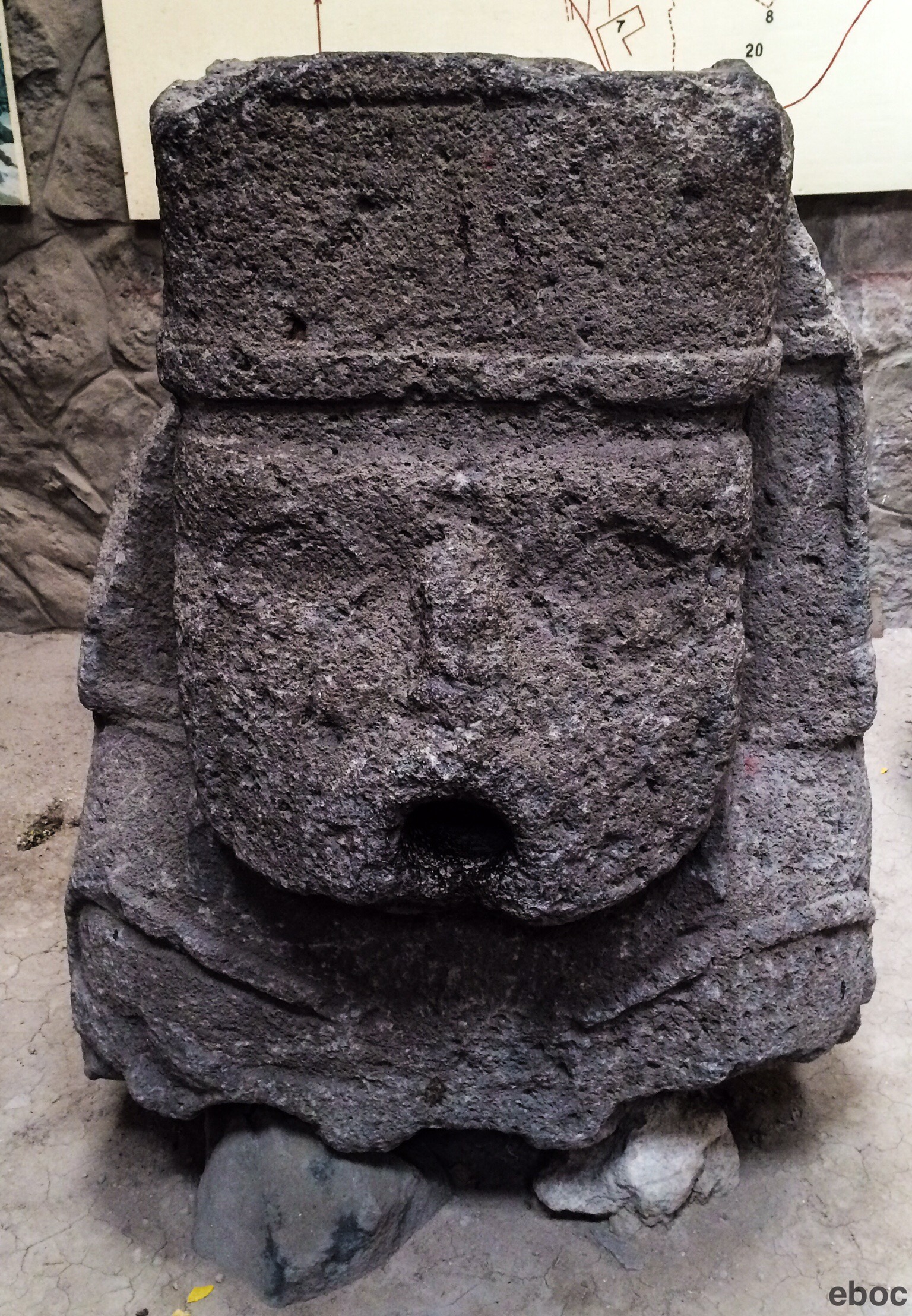
The Huari ( or Wari, “hua” is pronounced as “wa”) who lived around 500 to 1100 AD near the modern site of Ayacucho. The Huari were influenced by the Nazca and Tiwanaku cultures. 


They were ultimately conquered, and their numbers decimated, by the Inca.

 
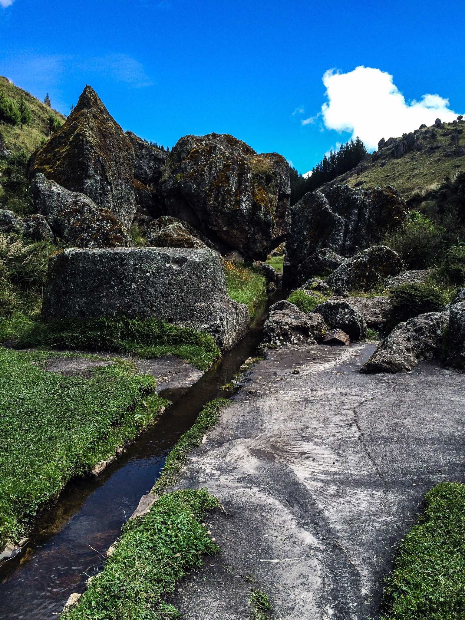
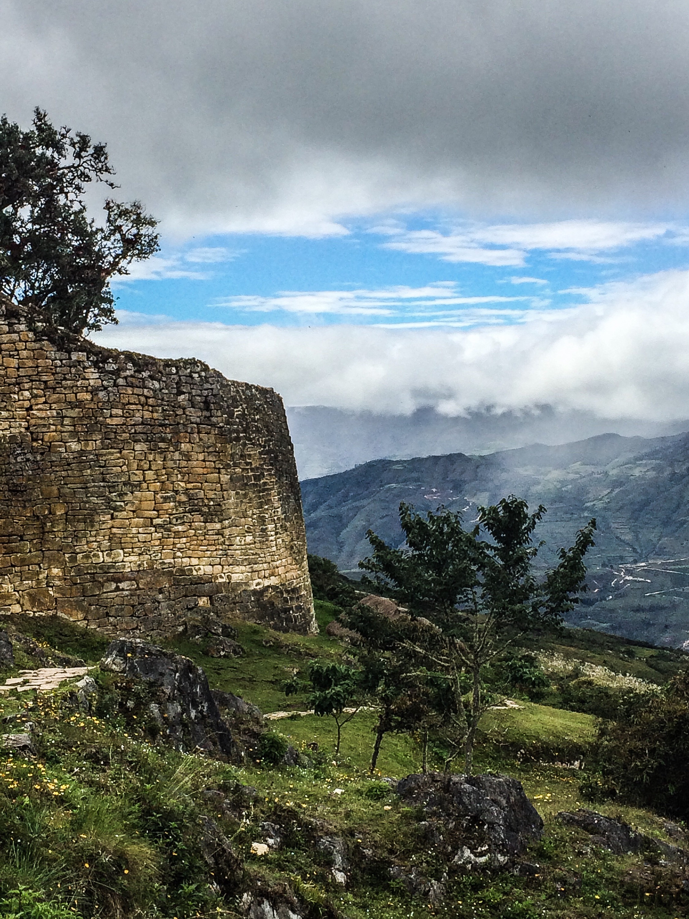
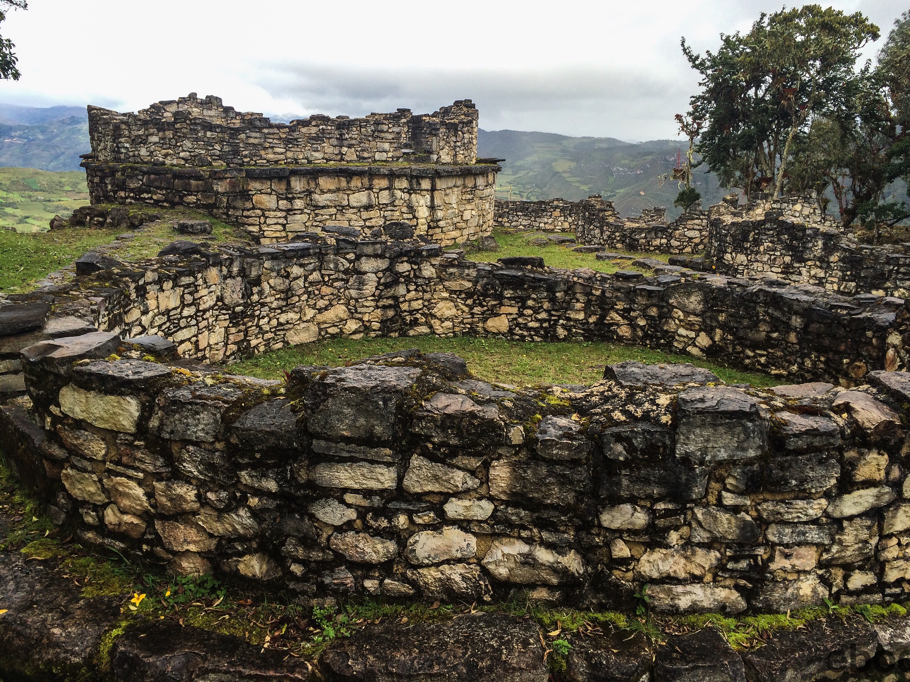
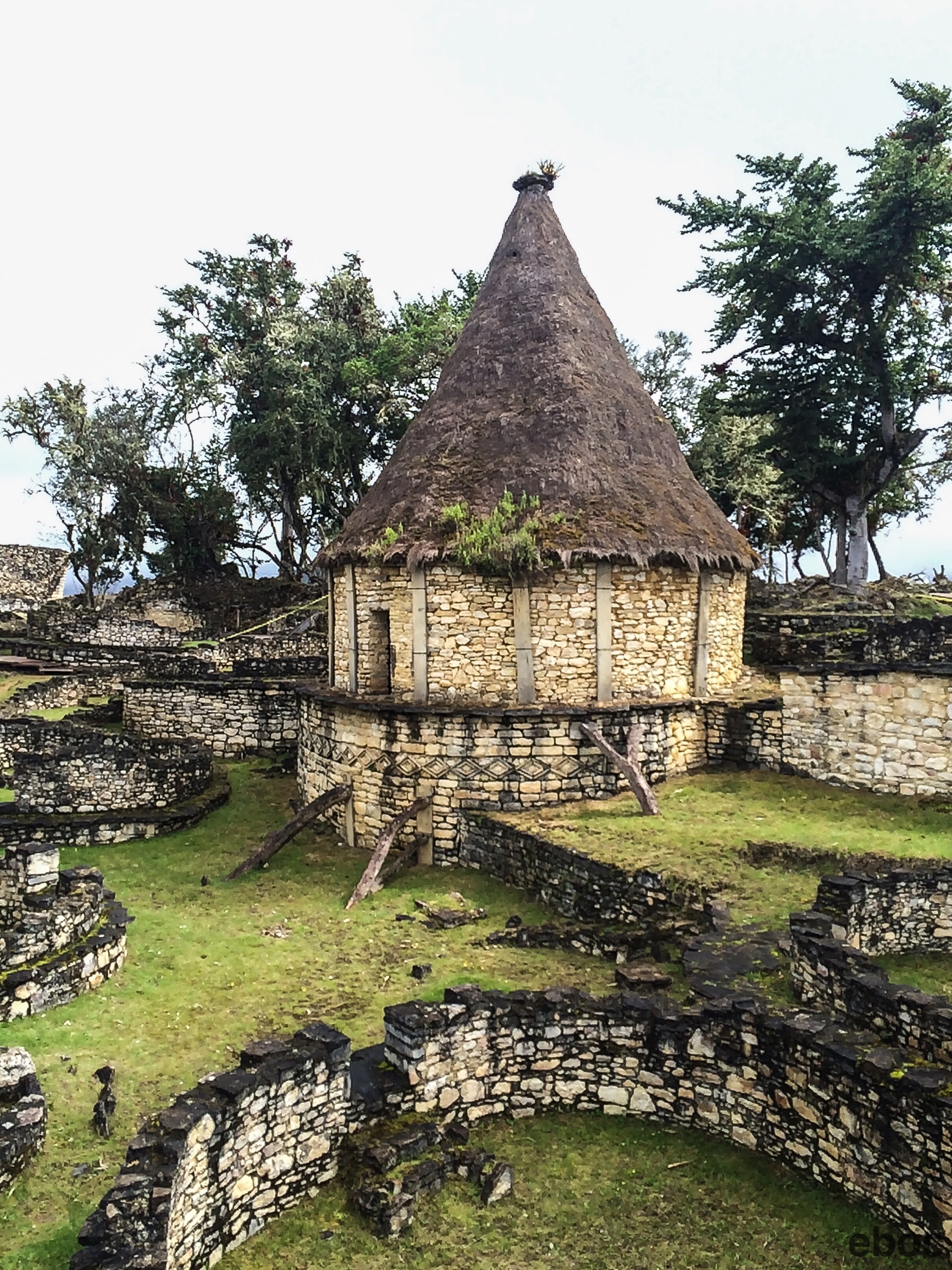
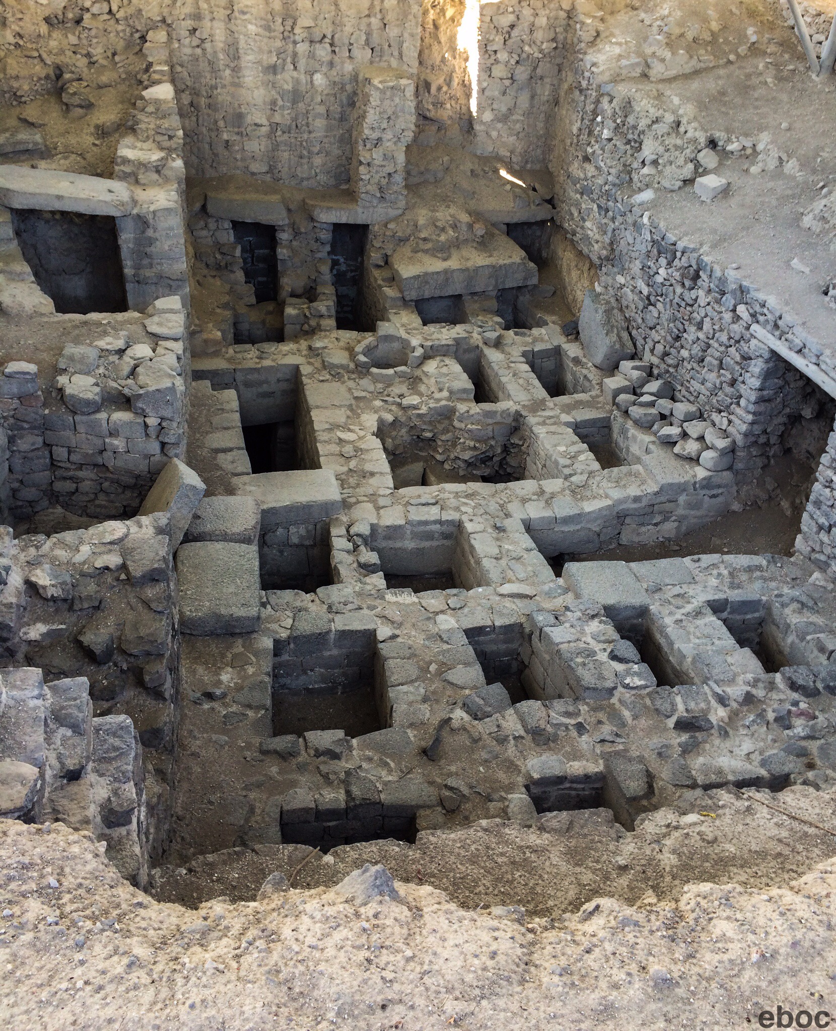
The ruins near Ayacucho are huge and excavation has just begun. I saw two of the 12 sites in the area. The city in its heyday was quite big with an estimated 40,000 inhabitants at its peak. 


Chan Chan, in Trujillo on the coast, is the largest archeological site in Peru. But people in Ayacucho claim that Huari will be larger than Chan Chan when excavations are completed. 


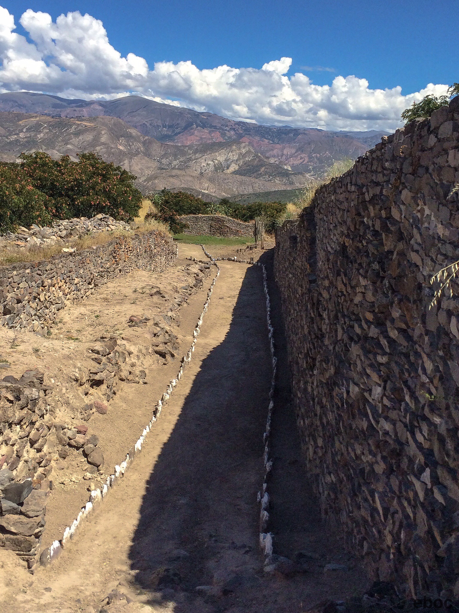
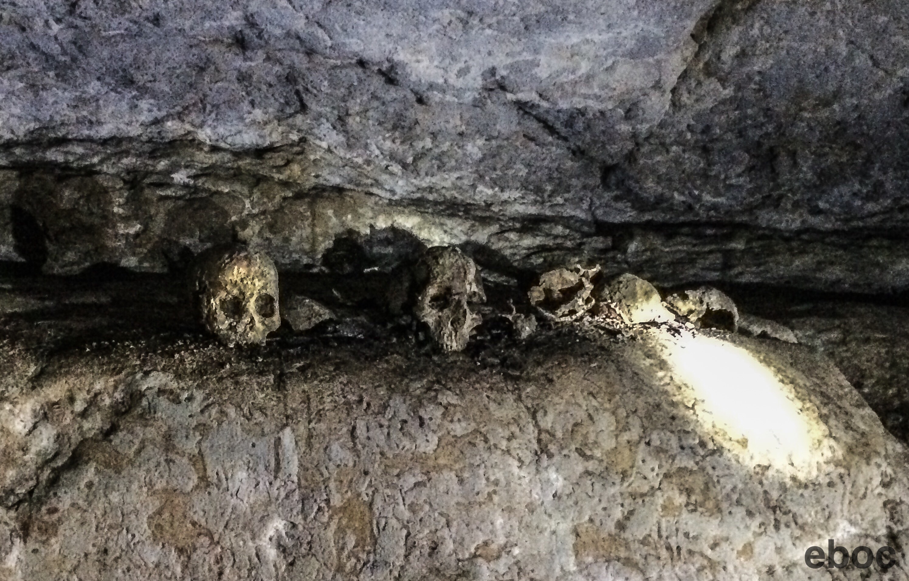
What is true that the Wari site is better preserved and hasn’t suffered as much from grave robbers. In a bizarre twist the terrorists helped preserve the area’s heritage. 


There were also remnants of the Warpa, who were a precursor to Wari. Warpa means antiguo (“ancient ones”).  


Beyond Wari is the village of Quinua. On the other side of Quinua is the pampa where the Battle of Ayacucho happened. It is was such a decisive victory that it is considered the end of Spanish rule in South America, in addition to the end of Spanish rule in Peru. It was fought by one of Bolivar’s young lieutenants, Antonio José de Sucre, in December of 1824. 


I always find visiting battle fields odd. Frequently they are stunning fields that happened to witness horrific bloodshed, but i found that hard to picture as I lay in the tranquil field. In this instance less than 1,000 of Sucre’s men died compared to 2,000 royalists. 


The next day I went on a tour to Vilcas Huaman, which is an Incan site several hours away from Ayacucho. 


Along the way we stopped to see Puya Raimondii, which are palm tree like plants that have a flower that can grow up to 30 feet. 


The ones I saw did not have the tall flowers and were young plants. To see the older, bigger plants we would have had to hike over to another mountain. 


Our next stop was an Incan site where the Incan ruler kept his concubines.  

Only the Incan ruler and his wife were allowed to visit. 
  

Acllahuasi — casa de las escondidas (“house of the hidden”) — housed women that my guide described as the Incan equivalent of a geisha. 


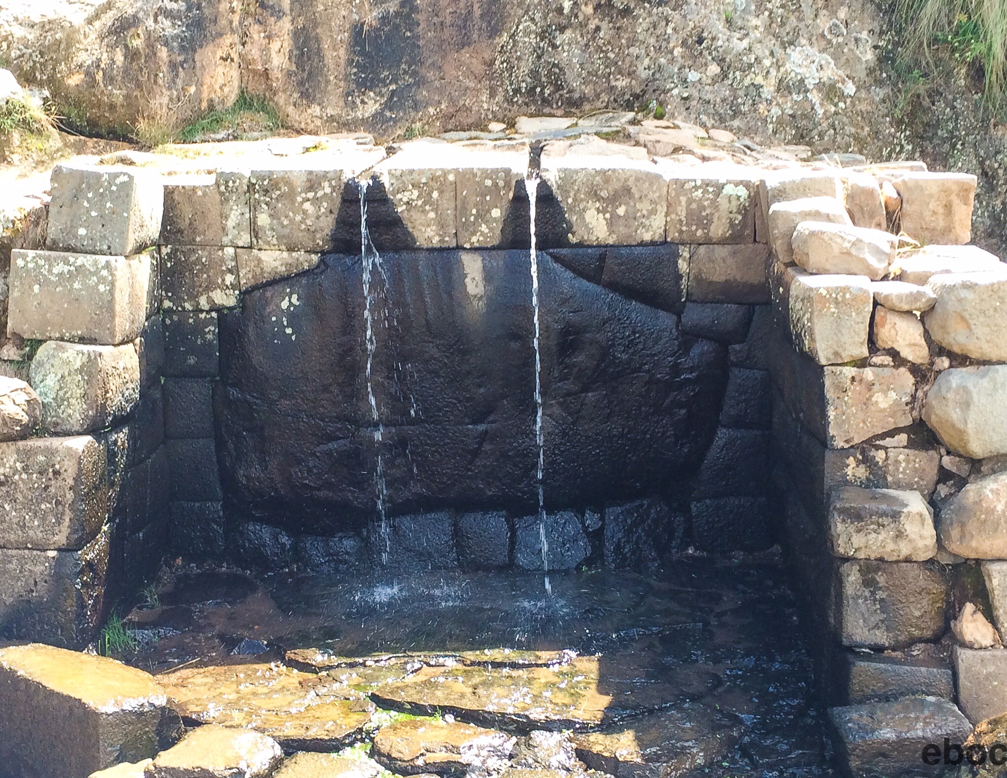
The ruins are next to a lovely lagoon that was constructed by the Incans. 


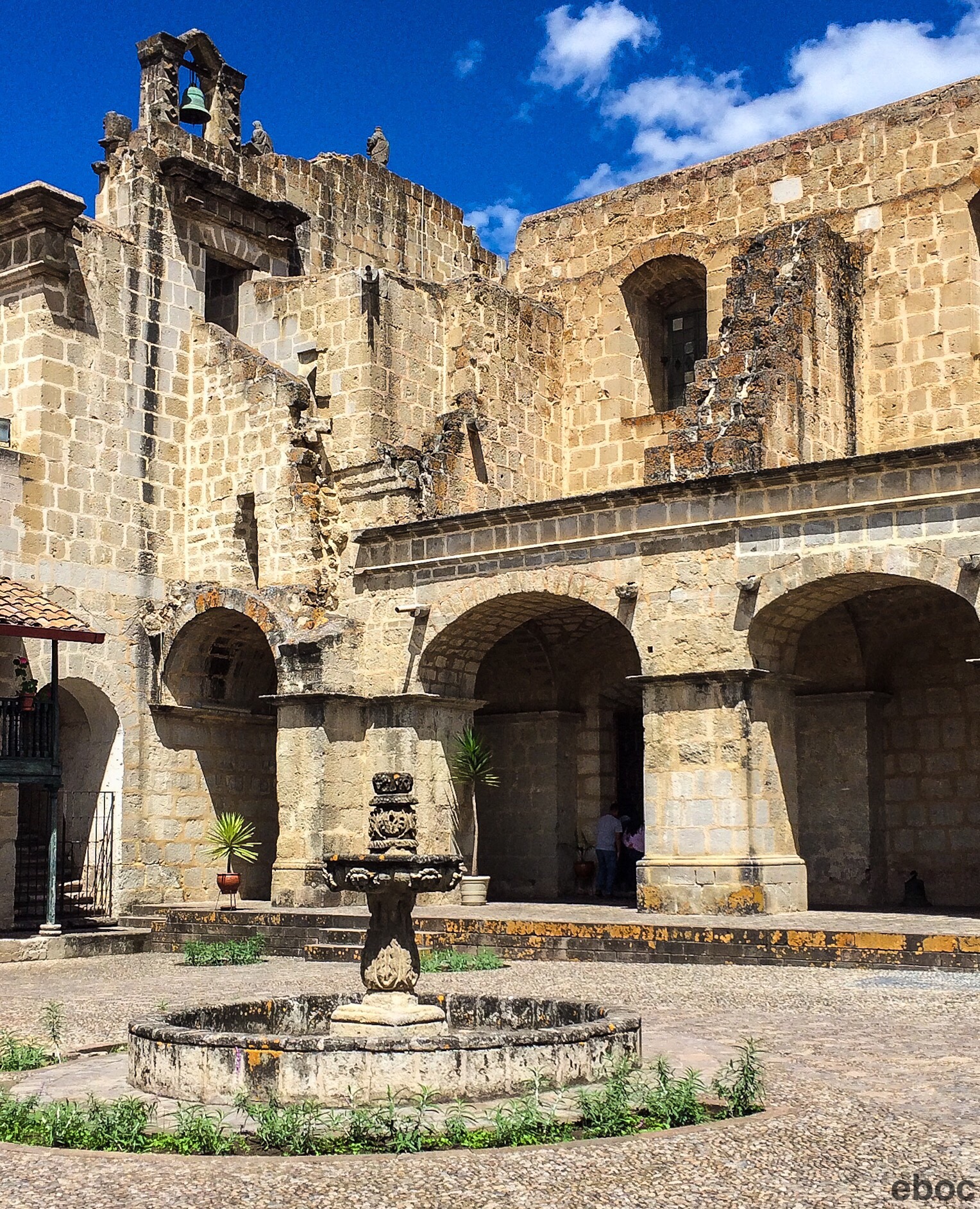
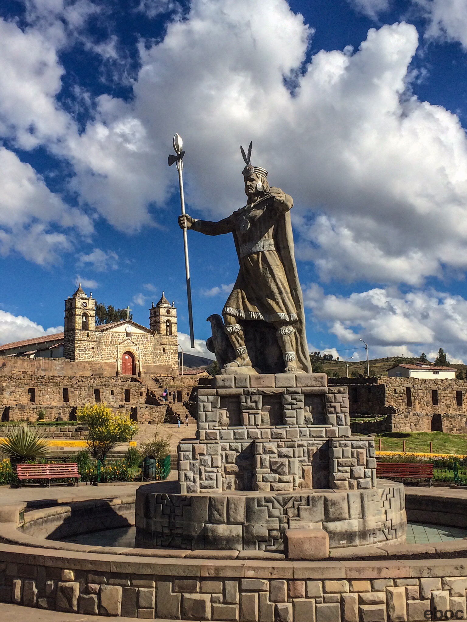
After lunch we left the paved road and spent three bumpy hours on a dirt road. We finally got to Vilcas Huaman in the mid-afternoon. Vilcas Huaman — halcón sagrado (“sacred falcon”) — is a modern town surrounding the Ushnu.


It is one of the few examples of a pyramid built by the Incas. It’s believed to have been used for performing rituals. 


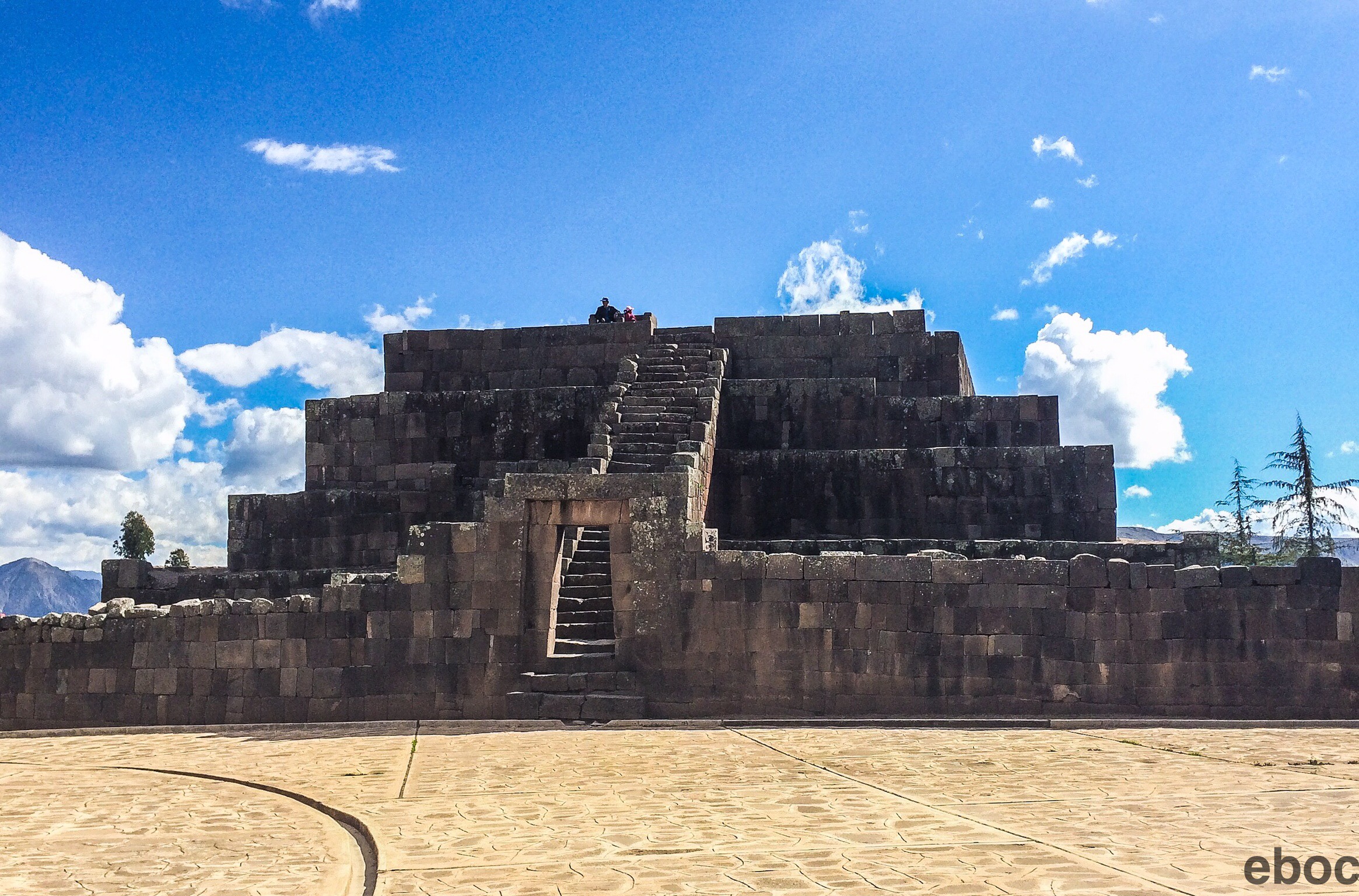
The other surrounding temples were pilfered for the stones by the locals. 
  

I was glad to see Ayacucho before tourism really catches on, and I think it would be fascinating to go back in 20 years to see how things change. 

Atahualpa’s Last Stand

Cajamarca, Cajamarca, Peru: The site of the Incas last stand, is a larger version of Chachapoyas. 


The two towns look very similar: Pizarro definitely left his mark. 


Cajamarca is another beautiful mountain town, but because it’s more easily accessible by road, and has an airport, it is at least twice the size of Chachapoyas.


After the Spanish captured Cusco, Atahualpa retreated to Cajamarca. It was then that his location was given up by the Chachapoyas. Atahualpa was held in the Cuarto del Rescate (The Ransom Room) and then executed as an example to others who might incite insurrection against the Spanish.


I took a day trip to one of the local archeological sites: Cumbe Mayo. 


Cumbe Mayo (Thin River) runs through a beautiful valley that was formed by volcanic activity there is an aqueduct dated 3000 years old. 


The rock formations are similar to some found in the Bolivian altiplano. 


It is decorated with pre-Colombian hieroglyphics from a culture long since extinct. Although a few of the images are similar to figures that show up later cultures, their meanings are unknown.

Parts of the aqueduct have been carved to redirect the flow of the water. 


Other parts have been carved more naturally into the rock. 


Cajamarca is a beautiful city to walk around. The only thing I’d hold against it is the lackluster food.


The Cloud People

Chachapoyas, Amazonas Region, Perú: Chachapoyas looks like I thought Huaraz would. It’s a cute little colonial city with whitewashed buildings and a picturesque Plaza de Armas complete with palm trees. Like Huaraz, it is surrounded by mountains.  

  
It is the regional capitol of the Amazonas Province and is one of the last Andean cities before getting to the jungle. It has a temperate climate but rains constantly. 

  
Chachapoyas means people from the clouds and refers to a pre-Incan people. Their language has been lost as has much of their culture. 
  
The Chachapoyas have a sad history: they were conquered by the Incans around 1453 and enslaved. In order to put down resistance Tupac Inca Yupanqui implemented a system to relocate the majority to other parts of the empire. 

When the Spanish arrived the Chachapoyas were instrumental in betraying the Incans because they believed the Spanish might free them. 

The Spanish were just as oppressive as the Incans had been and put them to work in fields. Most of the Chachapoyas were wiped out by sickness. 

  
The site of their defeat by the Incas is Kuelap: an enormous fort two hours outside of the city. 


Construction began around 900 AD and the second level was completed after 1100 AD. 

 
 The fort should have been impregnable but four days into the siege by the Incas the Chachapoyas ran out of water. 

 
Ironic given the amount it rained while I was there. 


In contrast to Incan architecture the Chachapoyas built round houses. This makes it easy to identify which houses were built before the Incan invasion at the fort. 

  
The next day I went to Karajia and Caverna de Quiocta. 

  
Caverna de Quiocta was a holy sight where the Chachapoyas performed rituals. 


There were several skulls lining the walls of the cave. 


To get to Karajia I hiked down to a narrow ledge beneath a waterfall. The sarcophagi were carved into the cliff side. 

  
The theory is the Chachapoya put the sarcophagi for their important chiefs up on the cliff to hide them from the Incan invaders, and to protect their dead from desecration. 


Up Where the Air is Clear

San Sebastián de Huaraz, Ancash, Huaraz, Peru: The gateway to the Cordillera Blanca: the city is surrounded by a ring of snowcapped mountains. The mountains are beautiful but Huaraz itself is not a great town. The Plaza de Armas features an unfinished church.

One of the spectacular day hikes from Huaraz is to Laguna 69. About 13 miles round trip, the hike begins at 3800 meters and ends at the lagoon, which is 4600 meters above sea level. 
 

The air is very thin up there. 


As I said, Huaraz is in the Cordillera Blanca (white mountain range) of the Andes. As opposed to the red mountains in Bolivia and Chile and the green mountains near Cusco and Arequipa the white is quite striking. It rains almost everyday so the white peaks emerge from very green valleys. 


The hike started next to a beautiful lagoon at 3800m and the foot of Huascarán, the highest mountain in Peru. 


I climbed down into a valley and followed a stream past free range cows. 


Then came the tough part: hiking up. It was probably only 300m but it was very slow going. All around me were small waterfalls cascading down from the glaciers. 

  
At the top of the ridge was another little lagoon and picturesque valley. As much as I enjoyed the scenery I will admit I was dismayed to learn I had to climb another few hundred meters to get to the Laguna. 


To go the short distance from 4100m to 4400m took me the better part of an hour. 
 
But like so many things the harder it is to do the more worthwhile it can be. The view was breathtaking. The group spent an hour next to the lake eating and listening to avalanches falling off of the glacier above. 


The walk back to the bus was really pleasant and I spent more time enjoying the view on the way back. 


Four Days in the Jungle

I spent my first afternoon in the jungle swimming in the Amazon River while pink and grey dolphins jumped in the water around me. 
  
Above, a quarter of a rainbow poked out of a cloud. To say it was surreal may be an understatement.

That same sensation repeated itself on my fourth morning. I watched the sunrise from a canoe in the same spot, but this time the dolphins jumped under an unbroken double rainbow.  


The guide said it was unusual because rainbows typically appear on the east bank of the river, not over the west bank.

The problem: the rainbow was so big I couldn’t get the whole thing in a picture.

Swimming in the river was fun but it’s very murky. 


The river is higher than it has been since 2012, probably due to climate change. Most houses, including the lodge where I stayed, are several feet under water.


In addition to hundreds of plants,  


birds, and insects too numerous to name I saw sloths,


howler monkeys, squirrel monkeys, giant bullfrogs, tarantulas,


scorpion spiders (the largest spider in the Amazon), myriad birds, a wild boar, meter-long iguanas, 


caimans (a type of crocodile),  

a tree boa, and a copperhead viper.   
 

I went fishing for baby piranhas.


I did not get a good look at the copperhead viper because as we were trudging through the swamp one guy on the tour was so excited to see the snake he grabbed at it and scared it off. I was behind him and froze because I no longer knewwhere the poisonous snake was in the water.

 
The guide told me it was okay to keep walking because the snake couldn’t bite me through my boots. Since the boots stopped a couple of inches below my knees I wasn’t really comforted.

 
Snakes were the things we did not see a lot of mostly by my guide’s design. He claimed that snakes are harder to find when the river is high, and while I’m sure that’s true in part, but he also told us a couple of war stories and he’s had some pretty close calls. While it would have been cool to see a giant anaconda, I’m not too broken up about it.

 
The Amazon is a spectacular place. It is a crime that our short-sighted modern culture is not protecting it.  We are destroying an amazing natural wonder.


Back on the Coast

Paracas, Ica, Peru: At my first glimpse of the Pacific I nearly cried: the mountains are beautiful and Lake Titicaca is stunning but it is still just a lake. It’s not quite the same. I have grown to love the mountains but I really missed the ocean over the last two months. 

My first dip in the bay was heavenly. Because it’s a bit protected the water wasn’t that cold, just delightfully refreshing. 

The main attraction in Paracas is Las Islas Ballestas that are affectionately known as “the poor man’s Galapagos”. It’s a short excursion that lasts 2 hours.

The first stop is along the coast in front of a giant candelabra whose origins are unknown. The lines are much deeper and wider than the Nazca lines. The guide provided several theories that made no sense after he told us it was carved 900 years ago. The candelabra is later than the Nazca lines but pre-free masons.

 
Obviously it was made by aliens!

The islands are full of cormorants, penguins and has a beach that is a breeding ground for sea lions. 

 
Baby sea lions are adorable but make an ungodly racket. 

 
The islands give off a pungent aroma: I mean it’s a really powerful smell. The government collects the birds’ guano and sells it. Most of it is used to make fertilizer in Peru but a fair amount is exported to Europe and Canada for the same purpose.

 
Government employees work in four-month shifts: they live on one of the smaller islands and collected the guano. They also insure that unauthorized boats don’t land to steal the guano or kill any of the animals. The workers are sent back to the mainland for a month to see their families and for medical exams to make sure inhaling bird droppings for 120 days hasn’t made them sick.

 
Big business in bird shit.
 
In the afternoon I went to the national park on the Paracas peninsula. It is the largest national park in Peru because it encompasses a large marine habitat; it is Peru’s only marine national park. 

You maybe wondering why the Islas Ballestas are protected but are not included in the national park. One of my fellow tour participants hypothesized that since the islands are just outside the park’s perimeter, the government can use the islands for commercial purposes.

 
From the park we got spectacular views of the ocean, beautiful rock formations, and beaches. The name, Paracas means place of sandstorms. “Para” means rain and “acas” means sand in Quechua. It comes from the language the the pre-Incan people spoke on the peninsula.

 
So while the views are spectacular you get a face full of sand as you try to take pictures.

At the end of the tour, we stopped in a fishing village for the freshest ceviche I’ve ever had.

A Desert Oasis

Huacachina, Ica, Peru: Ten minutes outside of Ica is a desert oasis — and backpacker haven — called Huacachina. Nestled between the dunes it is a great spot to ride on dune buggies, go sandboarding, visit Pisco bodegas, and relax by a pool. 

To go sandboarding the hostel loaded us up in dune buggies and drove out into the dunes. The ride was a bit like being on a rollercoaster. 


Sandboarding is essentially snowboarding on sand. After the first run most of us lay down on our boards and went down like we were sledding. Basically it’s awesome. 


The bodega tour was interesting but I can’t say much for Peruvian wine. What are your thoughts on saccharine grape juice?
It’s very sweet, which isn’t surprising since they’re growing grapes in the middle of the driest desert in the world. The lack of water in the grapes is noticeable.  
I do not like drinking Pisco straight, so the Pisco tasting was hard to swallow – literally. I was told on one tour that Pisco is fermented in conical shaped ceramic urns. The urns look birds beaks — pisqu in Quechua.  

I’d always thought the alcohol was named after the town. 

Lines and Mummies

Nazca, Ica Region, Peru: Night buses are brutal, but to get to Nazca it was the best way to travel. Continuing my tour of strange defunct cultures in Peru, the Nazcan geoglyphs certainly qualify as bizarre.

Getting off the bus at 8 am I was hit in the face with 95 degree heat. But man did it feel good to be back at sea level!

My first morning I took a flight in a teeny tiny Cessna. The flight lasted half an hour, and the pilot was a bit stingy when it came to flying over the sites twice (once to the left, once to the right), but it was amazing to see the scale of the lines.
 
The lines take up 500 square kilometers in the middle of desert. The Nazca people scrapped 10-15 cm off of the top layer of iron exposing white stone below. The iron keeps the lines warm during the winter and a hard shell, formed over the lines, protects them from sandstorms.
 
In the afternoon, I went to see the oldest aqueducts still in use. The Nazcans built them 2000 years ago, and they are still used to irrigate farms. There are only about 20 aqueducts still in use, but in Nazca’s heyday the system had more than 300.
I also saw the remains of an Incan administration building.
No one in Peru seems to like each other: even though there is a strong sense of national identity. The Cusqueños don’t like people from Lima; Arequipeñas don’t like anyone, and the Nazcans don’t like the Cusqueños because the Incas invaded and wiped out the Waris – the successors to the Nazca Empire.
Like most Incan ruins, it was pillaged for adobe bricks so the locals could build their houses.
More depressing, the next day I went to a cemetery that has been heavily picked over by grave robbers.
Many of the mummies remain, but their jewelry and much of the pottery is gone.
In the afternoon I went to the tower from which it’s possible to see the hand and tree geoglyphs.
Nearby is a museum dedicated to Maria Reiche, the mathematician who devoted her life to studying the lines. She also fiercely protected them; although she was unable to stop the Peruvian government from building the Pan-American highway across several of the lines.
Maria Reiche developed the theory that the lines were part of an astronomical calendar. Nearby the tower is a hill. From the top of the hill, the sunset lines up with one of the lines on the Winter Solstice: June 21.
Since she died no one has continued her research.

Semana Santa

Cochabamba, Cercado Province, Bolivia: The Saturday before Palm Sunday I was in Cochabamba, in central Bolivia, and I saw the most intricate palms for sale outside of the churches. 


Aside from the traditional crosses and simple palm fronds the women had woven elaborate crosses and what almost looked like baskets. These put the palms they hand out at my Episcopal Church to shame. They are really beautiful and some of the big crosses come complete with jewels. 


It surprised me even more to find that they were still available in La Paz on Monday, after Palm Sunday, and all through Holy Week. 


Would You Like to Buy a Sweater or a Llama Fetus?

Nuestra Señora de La Paz, Departamento de La Paz, Bolivia: My hostel in La Paz is very near the Witches’ Market (“Mercado de Hechicería”). In addition to Andean Crosses, jewelry, and any article of clothing you can imagine made out of Alpaca, they sell mummified llama fetuses.

From what I’ve read it was an Andean tradition to bury a llama fetus under a house for protection against evil spirits.

I’m not sure if that is still in practice but I would love to try and get one through customs.