San Pedro de Atacama, Provincia El Loa, Región Antofagasta, Chile: It’s been a while since I’ve been to a desert. I left Jordan in 2009 and haven’t been to a landscape as stark as the Atacama Desert since then. As a guide said to me, “the desert is beautiful but it is lonely.”
The town is very cute and looks like something straight out of Butch Cassidy. The adobe buildings are in the shadow of the Lascar Volcano that perpetually has a smoke cloud above it. San Pedro is a lot of fun and there are many wonderful things to do, but sleeping is not one of them.
My first day I left at 4:30 to go to the Tatio Geysers. Their claim to fame is being the geysers at the highest altitude in the world: 4200 meters. I thought the town, at 2400 meters, was high enough. Apparently altitude sickness is a real thing.
The geysers are very close to the Bolivian border. The Atacama desert and the entire northern section is part of the land Chile won when it defeated Bolivia and Peru in the War of the Pacific that ended in 1883.
We had to get to the geysers early because by 9 it is difficult to see the steam in the sunlight.
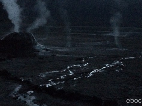
The water is 85 degrees Celsius and in the early morning the air is at about 0 degrees.
I can tell you that the stars up on the plane were brilliant at 6:30, but with so little light it was difficult to take pictures.
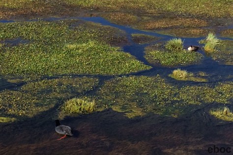
As we descended down the mountains I started to feel better almost immediately. We stopped several times:
– to see flamingos;

– at wetlands where there were red footed ducks;
– to see giant cactuses;

– and in the town of Machuca.
Our guide rather tongue-in-cheekily referred to it as a metropolitan area. The highlight of the village were the llama skewers and goat cheese empanadas.
Near San Pedro are two valleys: Valle de la Luna and Valle del Marte (Moon Valley and Mars Valley). They were named by a Belgian missionary. In the daylight rocks and sand in the Moon Valley look practically white, and the Mars Valley looks red. The Belgian monk’s Spanish was not very good and so the name was transcribed as Valle de la Muerte (Death valley).
The sunset in Valle de la Luna was really wonderful. As the sun set the different shades of red in the rock. It was a relatively cloudy night, which really enhanced the sunset.
The next day I went on a tour of highland lakes.
The first stop was a flamingo reserve. The flamingos were in a lake in the middle of a field of sulfur. The smell was potent to say the least.
I saw two types of flamingos: the Andean and Chilean Flamingos. The Andean has black tail feathers and the Chilean moves its legs in a distinctive way to disturb the water and bring the brine shrimp to the surface.
At the preserve I learned more about how the salt flats formed and why the flamingos have a pink tinge to their feathers (from eating brine shrimp) but the guide did not explain how the flamingos ended up on lakes above 2500m hundreds of miles from the coast.
After the preserve we went to another major metropolis: Toconao (at 2500m).

What I loved about these little towns, apart from their picturesque beauty, are the signs that we saw entering and leaving: Zona Urban (“Urban Zone”). All over northern Chile and eastern Peru are towns with 200 inhabitants and Urban Zone signs.
After several more hours of driving we made it to the salt lake. Very close to the Argentine border, because of the amount of nitrogen in the ground the mountains appear red.
Very near to Salar de Talar the lake is at the base of Cerro de Aguas Calientes. At 4000m the banks of the lake were unsurprisingly windy and cool.

Depending on the light and the wind the water turned from green to blue to purple.
Between lakes we drove past vicuñas in the shadow of a volcano. Vicuñas are the smallest of the four Andean camels and have the finest wool.

Our last stop was at two lakes that are separated by a ridge: Lagunas Miscanti y Meñiques at 4300m. The guide dropped us off beside Lake Miscanti and told us to walk to Lake Meñiques where he would have lunch set up and waiting for us. I was shocked how out of breath I was by the time I got to the top of the hill. Two days is not enough time to adjust to high altitude.


